Meridian
- Anna Hughes

- Jan 9
- 9 min read
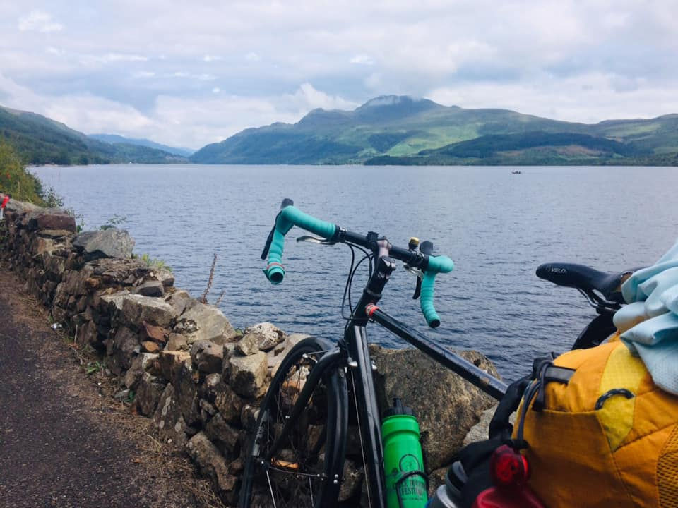
A ride during my '52 Bike Rides' project in 2021
The marker is easy to find: a plaque set into the pavement. 0º Meridian. Ahead, the road winds lane-like into the fields. Behind, a similar feel. Below, incongruous, a dual carriageway roars, sunk into a cutting, stridden by concrete.
Painted white railings separate us from the traffic below and a short way along, some bright yellow flowers are attached, their plastic green stalks lashed to the metal with a pink ribbon. A memorial. I pause. Someone died here. I look down onto the carriageway. The bridge isn’t particularly high but it’s far enough to inflict serious injury, and with the vehicles moving at speed, a leap would be certain to end it all. I wonder how desperate someone must be to make such a jump.
I must have said it out loud because Richard replies.
‘It wasn’t a jump. It was a car accident. Two girls. The car caught fire and the doors wouldn’t open.’
‘Oh, my god.’
‘It must have been maybe eight, nine years ago. There was quite a lot of damage there for a while.’
On the smooth, continuous tarmac below, vehicle after vehicle flows beneath, untroubled and uninterrupted, no indication of an accident, no sign of the horror that occurred right there, nothing to draw a driver’s eye.
Except that there is. In the verge, set slightly back from the edge of the road, a small patch of grass is cut short, and there stands a white cross. I didn’t see it at first. It’s the kind of thing you might miss if you were behind the wheel. A by-passed reminder of a life that is no longer there.
‘The car was shunted from behind. It caught fire pretty much straight away because of where the petrol tank was, just inside the bumper. They don’t put the petrol tank there any more just in case things like that happen. Anyway, the whole car had crumpled so they couldn’t open the doors.’
‘Oh my god,’ I repeat. No other words seem to fit.
Next to the flowers is a heart-shaped engraving, depicting two young women in ballet clothes, linking arms. Daniella and Charlotte. ‘We did Daniella’s funeral. An Italian family.’
For this is his neighbourhood: Richard, the local funeral director. It must be a strange existence, to be surrounded by fragments of tragedy. He knows the most heart-wrenching, vulnerable parts of our lives. Do the stories of the local people who have died ever leave him? The streets tell of the accidents he has cleared up, the homes of the people he has taken into his care, and by ‘care’ I mean a wooden box in a climate-controlled room. The pub is full of fellas whose parents he has buried: ‘You did my mum,’ they say as they buy him a pint. ‘Doctor Death’ they call him.
Surely you would become numb to the stories, in order to be able to do the job. But in amongst all of it you wouldn’t forget one like this. We ride away, sombre, thoughtful. I find myself thinking about that car and those girls for much of the rest of the day.
*****

The next marker is a bollard by the side of the road, Ermine Street, the old Great Cambridge Road, that used to be the A10 before the bypass was built. Black, squat, official. It bears a plaque that says, Greenwich Meridian centenary year 1985.
Most people will have heard of the Meridian Line, the world-famous line from which timings and degrees of longitude are calculated all over the globe, but not many will think about it, unless perhaps you go to Greenwich, where the Royal Observatory stands at the top of the hill, a line on the ground marking the place where east meets west. If you stand astride the line you can be in two hemispheres at once, something so significant yet at the same time so arbitrary.
The line bisects the country, stretching from Peacehaven on the south coast to Withernsea in South Yorkshire, on its way passing through this place, East Herts. It’s over 100 years since the Victorian navigators sat down together and decided that Greenwich would be the location of 0º longitude, the place from where time zones all over the world are measured. Greenwich Mean Time.
In 1985, as part of the celebrations to mark its centenary, local councils were invited to place markers wherever the line crossed one of their roads. In Walthamstow, East London, it’s a set of small discs set into the pavements; in Louth, Lincolnshire, a series of inscribed metal strips; and in East Herts, a simple black bollard. They stand, unassuming, tucked next to a bush, or beside a fence, or here, beneath the row of trees that lines the old coaching road.
Years ago I spent a day riding along the Meridian line with a group of friends. It was Ed’s idea – he called it the BeST ride, on the first day of British Summer Time, and we would follow the line southwards from Greenwich to Peacehaven, finding all the markers that stand at 0º.
We spent a slow day meandering towards the south coast, uncovering each marker: a pillar in a public park, a plaque on an outhouse wall, an inscription across the roof of a tunnel. It was my idea of the perfect ride, following a line of historical importance and ending at the sea where the cool waters would revive our road-weary legs.
Now I’m back on that treasure hunt, but heading north this time. The vague plan is to make it to the radio mast on Periwinkle hill – only about 15 miles away, but many more once we’ve included all the zig-zagging along the roads that cross the line. There are seven markers between here and there, each quietly heralding its place. An adventure through time and space.
*****
It takes us a long time to locate the next marker and we ride back and forth a few times, scouring the verge. Off the bikes, we check the map and the GPS. The compass app on my phone says we're almost exactly at 0º. Even with a fairly wide margin for error, we should be able to see it.
‘It should be here! Perhaps it’s been removed?’
Richard walks over to a section of holly that bulges outwards, wild and unkempt, at odds with the neatly-trimmed hedge. Pushing the leaves to the side he reveals a small concrete slab. ‘Probably the mowers can’t get in because of the stone.’
It’s knocked sideways, with a crack in the concrete. There’s a metal plaque mounted on the slab, the same as the one on the dual carriageway bridge: 0º Meridian. Tarnished, forgotten about. Placed there in a ceremonial flourish no doubt, but left to fall into disrepair in the decades since. Not all the markers invite the reverence that the inscription might demand.

Two more markers come and go: there’s plenty of reverence afforded to an obelisk in the St Edmunds school estate, protected by a wooden fence and a barbed wire perimeter, though less for the bollard placed next to a bin behind a bus stop off the A10. Then it’s into Buntingford and out the other side, up the hill to where the bollard is now accompanied by a tree. This oak tree was planted as part of the Millennium Tree Line project. I look it up.
The idea had been to create a line of trees along the Meridian Line, that would be a permanent and prominent indication of where it lay. Visible from the air; our Great Wall. A nice idea, but thwarted by reality. This was the 1990s, long before the days when you could whip out your phone and find out where 0º longitude was – even though GPS had been used by the military for years, it was deliberately degraded for civilians so the accuracy was only around 100 metres. Finding the exact spot to plant each tree was much more of a challenge than it might have been, and even when the locations were found, land owners needed to be contacted and persuaded to take part – a lengthy, ultimately disappointing process. The few trees that did make it into the soil suffered from lack of aftercare, and most of them died. Then their replacements died. Ultimately, the project died along with the trees.
Another zig zag, another detour, another oak, this time in the pretty village of Wyddial, just a handful of houses and a few farmsteads and a squat parish church. Then we’re in the wide open countryside once more, to the penultimate marker of the day: one more bollard and one more oak. A car glides through the undulating farmland, its driver oblivious to the tree and why it’s there. A beacon, standing alone in the farmscape, unclustered by hedges or buildings. One of the ones that survived, but for how long? Will it be removed at some later date in favour of uninterrupted fields, when its roots become a nuisance for the farmer? Or will it reach its 300 year maturation, then live its 300 year life, then complete its slow decay for another 300 years?
*****
‘That must be it.’
‘Isn’t that a pylon?’
‘It’s far too big. I reckon that’s it, the radio mast.’
‘Where’s the hill?’ I had been expecting some kind of pinnacle, a much more notable conclusion to our quest, but ‘Periwinkle Hill’ seems to be just another field, much like those that we’ve been riding past all day.
There’s a slight incline though, enough of a gradient that it’s a slow approach to what is now unmistakably the mast, and when we reach the ridge, the name 'Periwinkle Hill' makes sense. Looking north, it’s clear just how high we really are. The fields fall sharply away on the other side, the map a flurry of contour lines, dipping into the plains that stretch for miles towards Cambridge, where we can make out the white roofs of the science park beneath a sky patched with clouds and sunshine.
Solid metal gates surround the mast, so there’s no getting close to it. I’m fine with that. Up close it’s monstrous, the kind of structure that is simultaneously compelling and terrifying. I wonder if it was intentionally built on the meridian line, or if they realised afterwards? I hope it was intentional. The Meridian Mast.
We look south, down the barrel towards Greenwich and all the markers we’ve ridden past, all the bollards and plaques and trees and obelisks. It’s a unique phenomena, an art instillation, a story of history and geography that melts into its surroundings so that it’s barely even there. The line that runs from pole to pole beneath our feet. Maybe it’s a good thing the tree line never materialised; part of its charm is its mystery, its intangibility, its invisibility.
The light is starting to fade. If we stayed longer we might soon be able to see the Meridian laser that shines northwards from the Greenwich Observatory, 36 miles away, splitting the sky in two. If the conditions are right you can spot its steady green glow stretching out from the capital, up into the night sky. Apparently this point, Periwinkle Hill on the edge of Cambridgeshire, is the last place you can see it with the naked eye.
Turning to look northwards across the Cambridgeshire plains I am itching to carry on, imagining the next marker nestled in the valley just a handful of miles away, wanting to keep on with the hunt until I’ve found them all and the line tips over the edge of a Yorkshire cliff into the sea.
But it’s time to head back. It will be much more direct on the way home, just an hour or so, a straight route by-passing the detours we took to find the markers. I think back to Ed and Tom and Sam, and the BeST ride all those years ago. Time and geography have got in the way and I haven’t seen any of them for years. They would love it that I was now following the route that we’d started all that time ago.
*****
In the end I had never made it to Peacehaven with the rest of them. I’d crashed out taking a downhill too fast and had slammed my elbow into the tarmac, the following miles marred as my bones shuddered with every bump in the road. By the time we had reached Lewes, just eight miles shy of the south coast, I’d had enough. Desperately disappointed not to finish, I turned for the station. As my train zoomed through the Surrey countryside Ed sent me a picture of their three bikes on the seafront next to the final marker of the mission, a chalk-coloured obelisk with a globe sitting on the top, the most southerly point of the Prime Meridian in the UK. The sky was once again changing to the colours we had seen that morning in Greenwich, now with the evening hues of grey-blue and orange.
One day I will go back there and take the picture I never took, then turn north and ride the entire line until it runs out. A ride both random and structured, with an artificial narrative and an excuse to go exploring. Maybe it will take a week, maybe more. I’ll camp wherever I can find a spot, each evening falling asleep under the green beacon until that too fades into the dark sky.


My love, you are the most beautiful part of my life, and every moment with you is a precious gift. ❤️ Thank you for filling my heart with happiness, trust, and endless care. Your love gives me strength, comfort, and countless reasons to smile every day. I wish for our bond to grow stronger with each passing moment, bringing us more joy, understanding, and unforgettable memories. May our journey together always be filled with love, laughter, peace, and endless happiness. 💕love wishes
Paglu Game download was quick and easy. The game offers great entertainment with interesting features and levels. I’ve been playing daily and it keeps getting more engaging every time.
DG Club login was quick and easy. The game offers great entertainment with interesting features and levels. I’ve been playing daily and it keeps getting more engaging every time.
V3 Game download was quick and easy. The game offers great entertainment with interesting features and levels. I’ve been playing daily and it keeps getting more engaging every time.
Un relato muy emotivo y lleno de reflexión que invita a valorar cada momento de la vida. lotería de hoy también es una búsqueda frecuente para muchos usuarios, mientras este artículo transmite sensibilidad, memoria y una narrativa realmente cautivadora de principio a fin.